- Home
- » Researchers
Researchers
Listed below are some of the University of Southampton research staff affiliated with the Open Source Geospatial Laboratory.

- GeoData Institute
- Geography and Environment
- The GeoData Institute specialises in environmental data management, analysis and processing. Our approach has been founded upon a commitment to integrated, multi-disciplinary projects emphasising science and survey with a strong basis in data handling and promotion of access to environmental and social information.
- GeoData has a long track record in the use of open standards for Spatial Data Infrastructure (SDI) and the development of highly specialised open source geospatial applications, including sophisticated web mapping and data management portals and desktop GIS tools.
- The GeoData Team:
- Chris Hill
- Jason Sadler
- Julia Branson
- Craig Hutton
- Andrew Murdock
- Duncan Hornby
- Andrew Harfoot
- Gemma Gubbins
- Homme Zwaagstra
- Jeremy Austin
- Ian Waldock
- Oles Kit
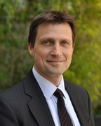
- Professor Pete Atkinson
- Geography and Environment
- The focus of my research is in all things spatial! This includes remote sensing, spatial statistics, geostatistics, and spatially distributed dynamic process modeling applied to a range of environmental and socio-economic phenomena. Particular subject interests are natural hazards (including flooding, landsliding, near-Earth objects) ecological and disease systems, and monitoring vegetation phenology in response to climate and anthropogenic drivers. Specific technical interests include spatial scaling of images (including development of new techniques for downscaling), optimizing spatial and space-time sampling designs, spatial risk mapping, agent-based modelling and data assimilation for model-based forecasting.
- I have published around 150 peer-reviewed articles in international scientific journals and my Thompson H-index is 28. In addition, I have published around 45 refereed book chapters, edited eight journal special issues and eight books, and edited a large Theme on Geoinformatics for the UNESCO Encyclopaedia of Life Support Systems. I am Associate Editor for Computers and Geosciences and sit on the editorial boards of Geographical Analysis, Spatial Statistics, the International Journal of Applied Earth Observation and Geoinformation and Environmental Informatics and have previously edited the International Journal of Remote Sensing Letters for nine years. I have supervised 45 PhD students, 26 of whom have now graduated.
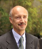
- Professor David Martin
- Census analysis methods - spatial modelling of population
- Automated zone design
- Population application in GIS
- Delivery of health care
- David is a co-Director of both the ESRC UK Data Service and ESRC National Centre for Research Methods. From 2002-12 he was Director of the ESRC Census Programme. In August 2010 he was appointed as a member of ESRC Council. He served as Head of the then Department of Geography at Southampton from 2000-3 and as a member of the University's audit committee from 2006-12.
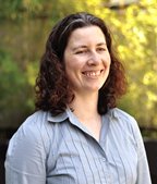
- Samantha Cockings
- Geography and Environment / Population
- Health and Well-being
- Research interests in space-time modelling of populations (Pop24/7 project) and automated zone design (AZTool software and Census2011Geog project), both of which have delivered freely available software tools. Interested in using and developing open source data and tools for these and other projects. Teaching: GIS and geographies of health.
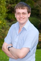
- Robin Wilson
- Geography and Environment
- Robin is a PhD student working jointly within Geography and the Institute for Complex Systems Simulation on developing novel methods for monitoring air pollution from satellites, focusing particularly on increasing the spatial resolution of these products. He has released a number of pieces of open source software (see www.github.com/robintw) including Py6S (a Python interface to the 6S Radiative Transfer Model) and RTWTools (a set of extra processing tools for the ENVI remote sensing package). He has also contributed code to the GDAL library and is a user of QGis, GRASS and PostGIS.
- Dr Kirk Martinez
- Electronics and Computer Science
- We have expertise in making linked data from data streams - and semantically marking up the data. Our Web and Internet Science group has been involved in projects ranging from semantic sensor networks (FP7) to Open Data initiatives.
- Kate Parks
- Civils
- Maritime and Environmental Engineering and Science Unit
- Environment Group
- My interests lie in the use of GIS to guide conservation decisions. My previous research has focussed on the development of a pan-tropical scale assessments of geodiversity (spatial, temporal and total diversity of biologically important). I have used the output of this model to test the robustness of the existing protected area network within Colombian mountains under a range of climate change scenarios. More recently, I have been working on mapping provisioning ecosystem services within Madagascar and determining the impact of climate and land-use change on these services. I generally carry out my analyses using the PCRaster Python framework, with freely available datasets, but am keen to develop expertise in other OSGIS.
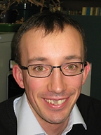
- Dr Simon Blainey
- Transportation Research Group
- Faculty of Engineering and the Environment
- Simon is involved in research on a range of transport-related topics, and is particularly interested in the use of GIS and geospatial statistical techniques such as Geographically-Weighted Regression to explain and forecast the use of such networks. He has made extensive use of Ordnance Survey geospatial data in a number of different research projects, in particular in the development of an appraisal framework for new local railway stations, and in the production of a long term model of UK transport infrastructure demand and capacity as part of the Infrastructure Transitions Research Consortium.
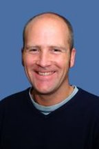
- Richard Treves
- Geography
- I am a learning developer with interests in UX (user experience), UI and cartographic design. I am interested both in the usability of OS tools themselves and also in the US and usability of the geovisualisations that can be produced with them.


